Want to paddle the Stave? Click here.
While the boating in southwest BC is excellent with a long season and a ton of variety, you can count on one thing for a lot of the rivers - they're short. Many of the runs once you know them can be blasted out in less than an hour, and you often spend more time driving down a dusty dirt road then in your boat kayaking.
There are several well known multi day trips in the area (and I guess you could string together some of the rivers with multiple sections), but they are usually not super diffficult (Stein, Clendinning) or they are known to beat the shit out of your gear (North Stein) - this, and wanting to do a little exploring led us to the Stave River. The Stave is one of the south flowing rivers that drains Garibaldi Park.
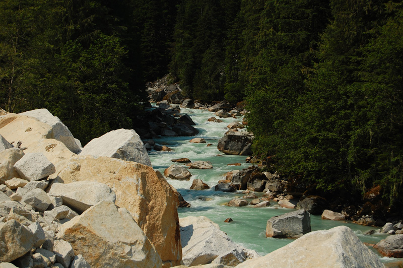
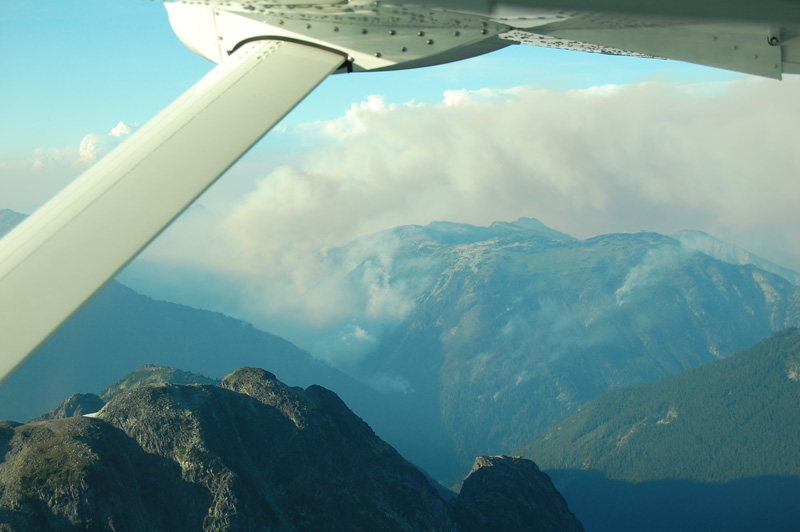
Our interest in the Stave first came about from trolling about on Google Earth - the whole river corridor can be followed using high resolution satellite images and what we saw looked good - well, what was saw was a lot of white in the river bed, a few big canyons and access that would require a float plane.
Aside from what we could see on Google Earth, there wasn't a whole lot of information about the Stave out there - a crew of guys ran it back in the early 90's and seemed to have a hell of a trip - and by hell I mean horrid. They went way over schedule (5 days total?) and ended up having some massive portages. Well, being 15 years later and with at least some idea the river was runnable we figured we'd bash through the whole thing in three days and have a good look at some of the canyons in the middle of the river that were undoubtedly the cause of the big portaging. If it was portaged once it could be done again if the whitewater did prove to be too much. The biggest unknown were flows - August seemed a good time to sort it out - things are usually dropping by then, but the glacier fed streams like the Stave still have flow. So, July 31 we took off from Whistler to land on the lake below the Stave Glacier too see what the Stave would have in it's valley.
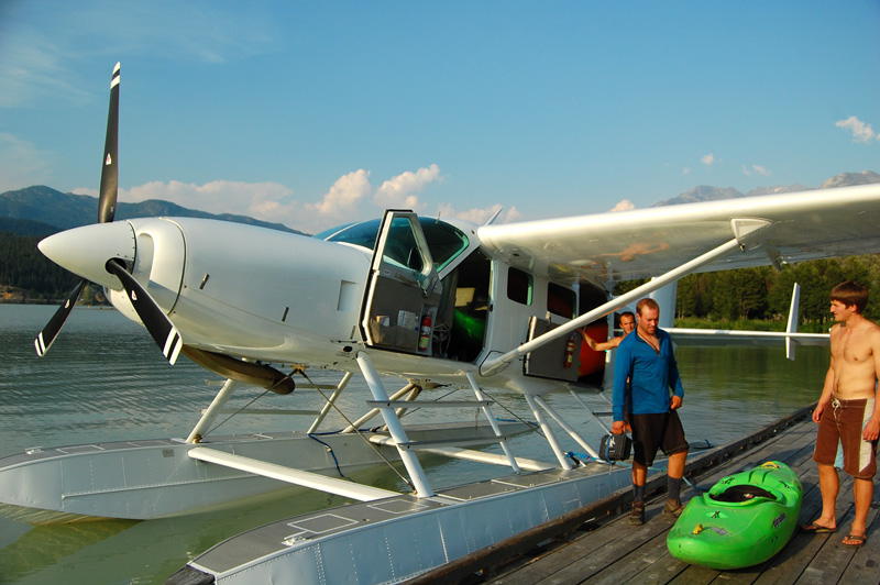
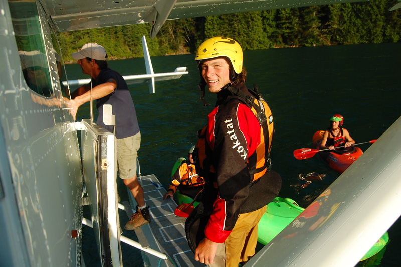
Loading the plane - Whistler Air's Cessna Caravan.
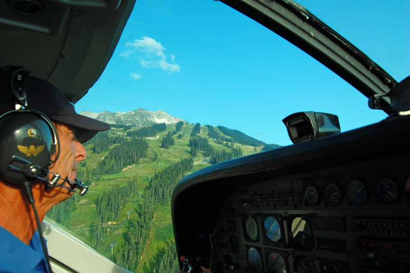
Our pilot Mike, and a fleeting view of Blackcomb mountain out his window.
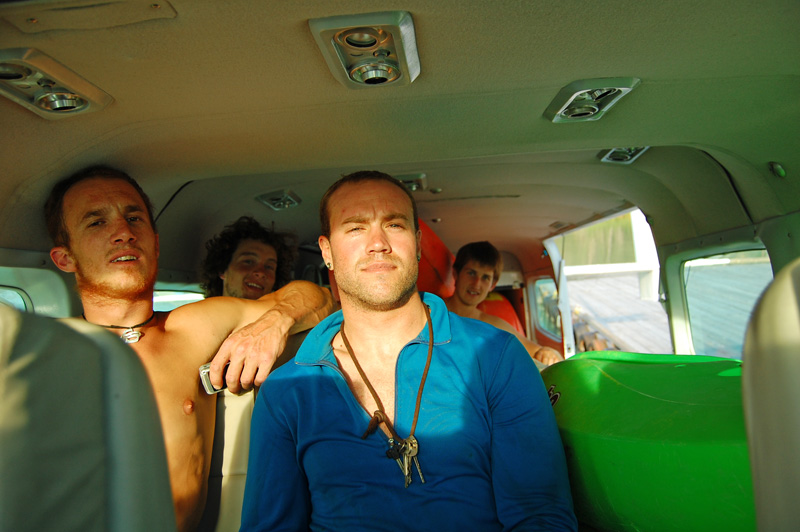
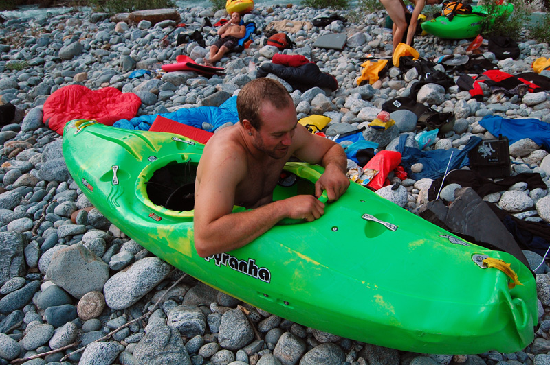
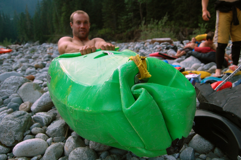
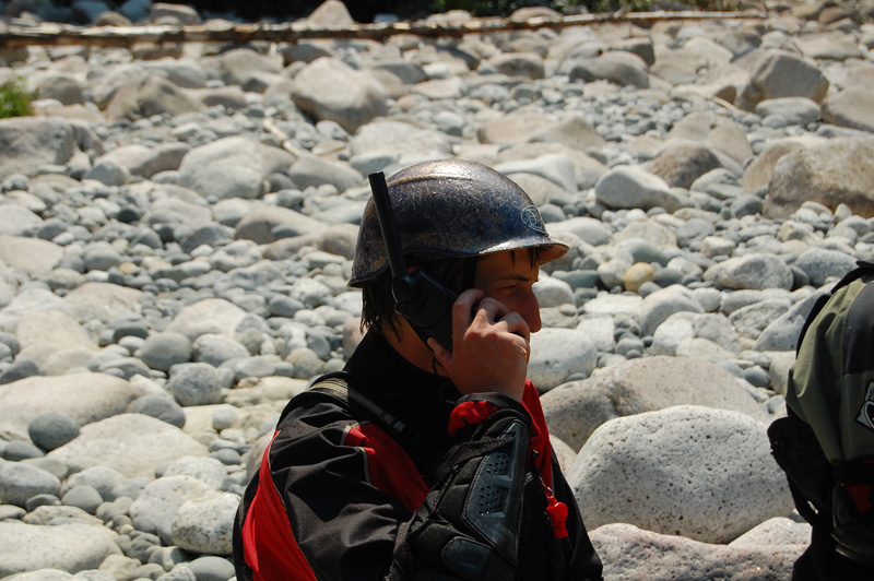
The crew - Matt Kompass, Max Kniewasser, Steve Bartrom, Corey Boux.
A hazy view of the headwaters of the Cheakamus River in behind Whistler mountain.
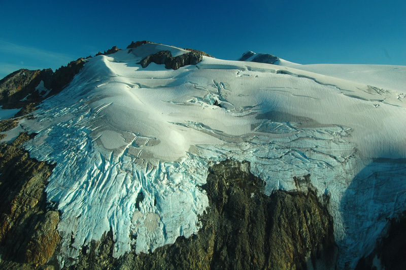
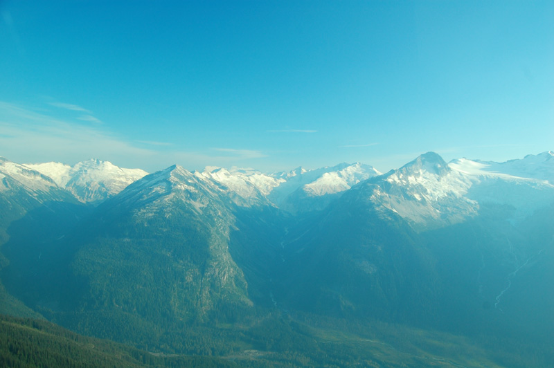
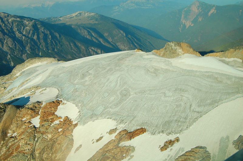
The amount of ice in the mountains is incredible.
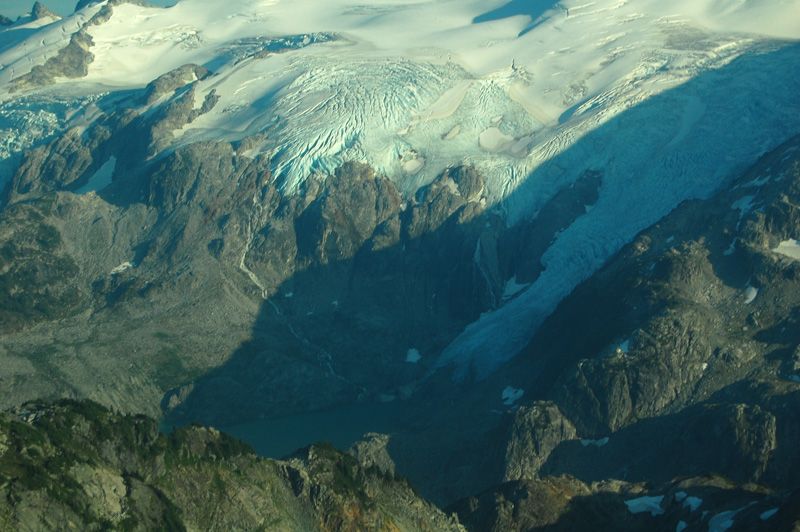
This is the headwaters of Snowcap Creek - more ice.
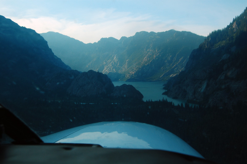
Coming in to land on the lake below Stave Glacier.
We flew in the evening before the first day of boating, and ended up paddling across the put in lake and down the river for a few km to the first whitewater where we set up camp. We brought in a few beers, but half of them were lost forever after Matt let them float by his boat as he got in from the plane - they floated when tested, but went under just enough to be lost in the extremely silty water. After a major heat wave in BC right before our trip all the rivers in the area we running brown and muddy, and the Stave was no exception. The high water brought on by this heat wave had brought the river way up (beyond what we set at too high to put on) just before our put in date, but it came down just enough to start out on the day we wanted to.
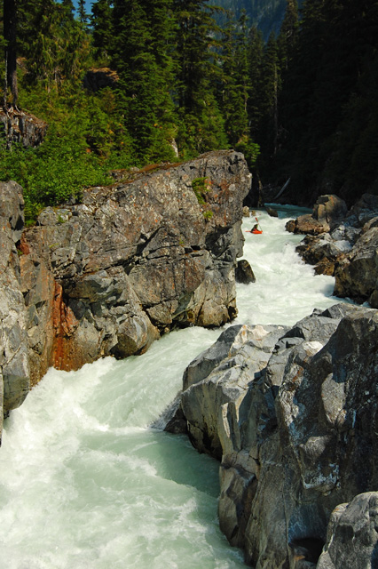
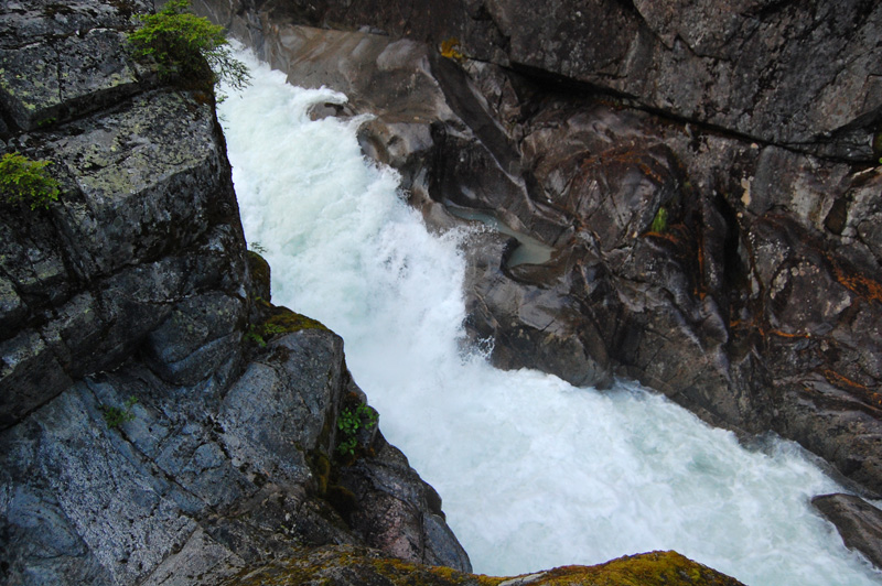
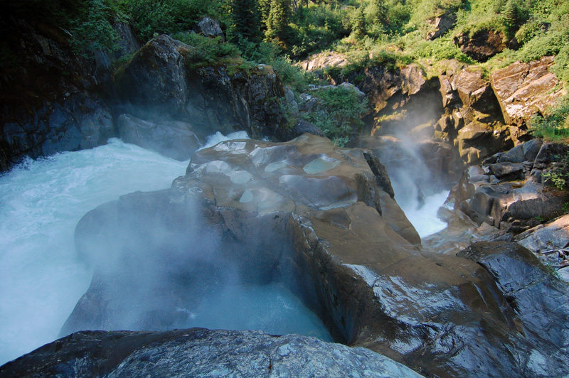
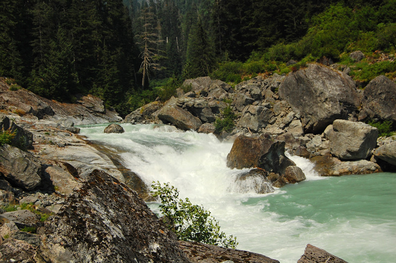
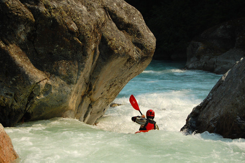
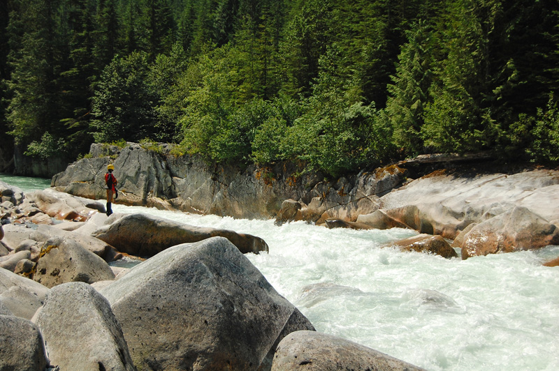
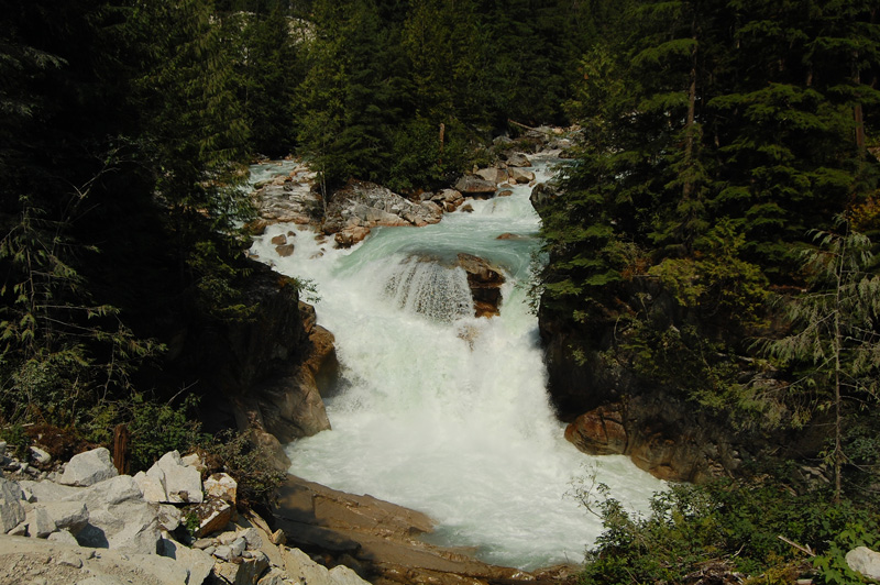
A quick scout downstream revealed a canyon - the first canyon. I wasn't really expecting a canyon this early on, but as far as we could see downstream looked good, even if there didn't seem to be a lack of water. In the morning, the water level fears were somewhat eased as the river level dropped substantially - the Stave ended up having a big diurinal cycle - and we dropped in. What ensued was several kilometers of absolutely phenominal class IV-V boating through a committing canyon that was all runnable. Needless to say, spirits were high when we paddled out of the gorge an hour or two later.
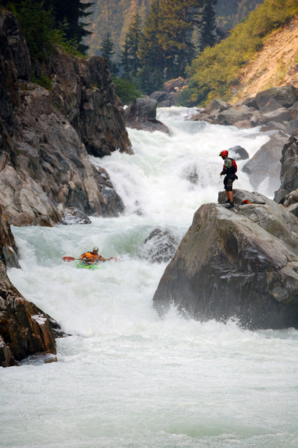
After a short calm section with great mountain views we came to a rumbling horizon line - we found a big rapid with a long lead in, a tough move in the middle around a headwall and a boiling eddy ending with a big squeeze to sub manouver. Everyone walked except for Steve - he didn't make it, and after a tough rescue out of the boiling eddy in the middle of the rapid we got him to shore and managed to wrangle the boat a few hundred meters downstream. It was hard watching the boat float around the corner, but luckily things were calm after this drop and we were able to catch up.
The second half of the first day was largely wide open valley. A lot was great read and run, with one section in the middle that took quite a bit of time to sort out with several notable rapids in quick succession that required some not straightfoward scouting (at one point we thought we were at the head of the second canyon we were expecting). Late in the afternoon, everyone was looking forward to camping out - in the midst of some aggressive boat scouting we were looking for campsites without much luck and rounding a corner we suddenly came upon the second big canyon we were expecting. Just as everyone was getting out to take a look, Corey paddled past the eddy we were in and dropped in, sight unseen.
Packing up after the first night out.
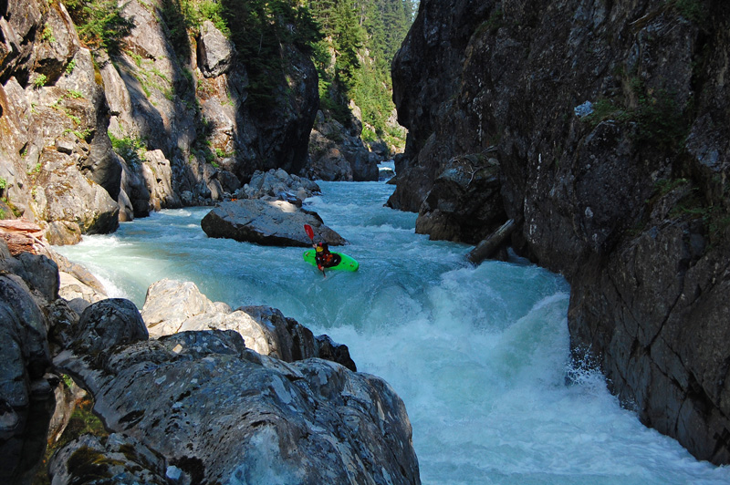
One of the first rapids in the first canyon.
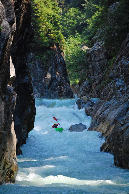
Steve Bartrom - no photo captures the character of the first canyon better than this.
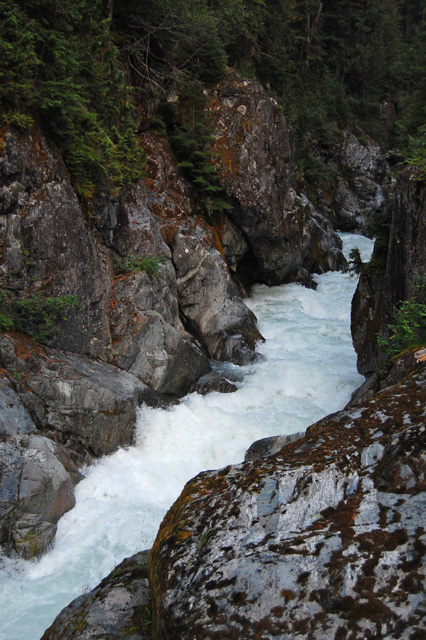
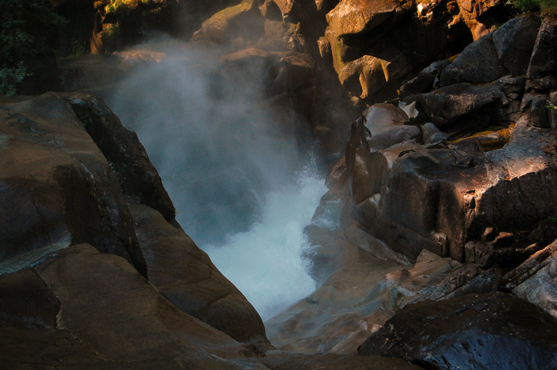
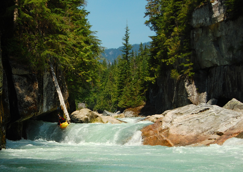
The exit drop of the canyon.
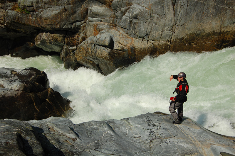
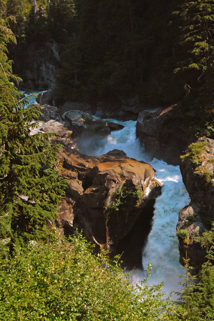
I'm not sure what this river signal means, but that's a big pinch at the bottom of that rapid.
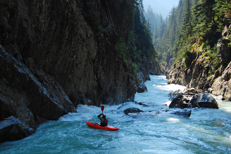
Steve Bartrom dropping in to the big rapid after the canyon.
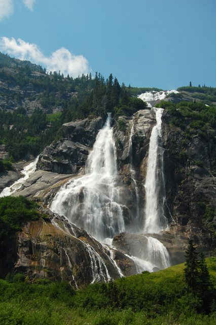
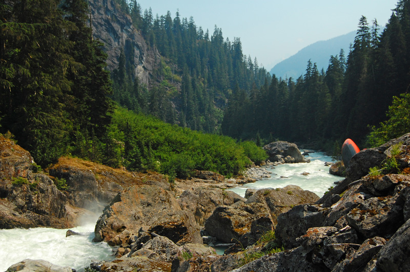
The mountain scenery is nothing short of amazing on the Stave.
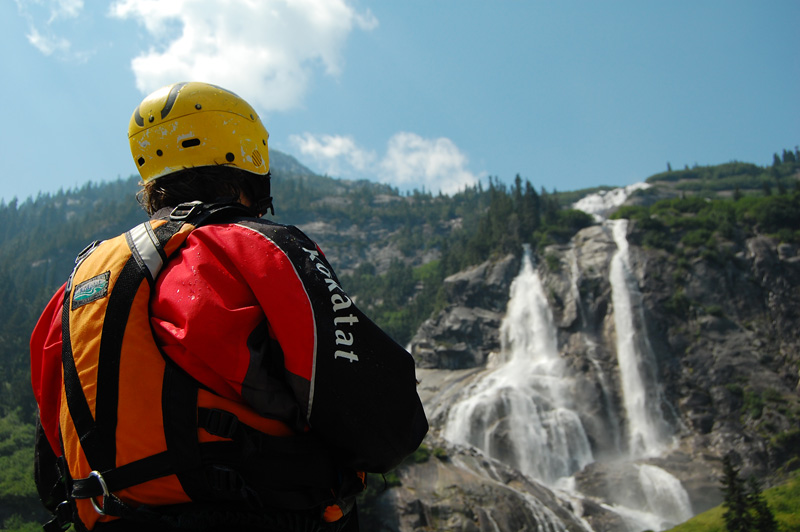
Max taking in the fantastic scenery.
Dropping in to one of the open valley rapids just before the end of the day one stretch.
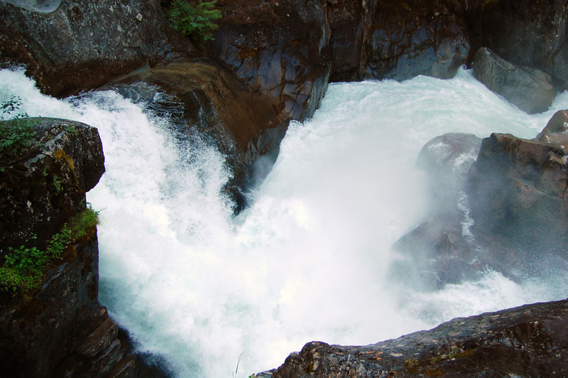
It was clear that the rapids here were something big, but being in the bombing mindset Corey figured it was just another rapid we could bomb. After hurrying downstream and seeing the fury below, and no sign of Corey, the alarm was sounded and we crashed along the rim of the canyon in a mad search for him. After 10 or 15 extremely tense minutes of frantic searching and calling (and seeing a ton of V+/VI in the canyon) we finally heard a call from down at the bottom of the canyon - he was alive, although in a somewhat dubious spot.
So, here's what happened. After dropping over the first drop of the canyon, Corey survived for a few seconds in his boat, but was quickly removed from his craft, where he continued to swim through the canyon (some of it is pictured below) and over a 25-30 foot waterfall in the heart - after almost too much time underwater he finally washed into an eddy (the only eddy) on river left, still in the gorge and above a massive horizon line. Luckily, this eddy was opposite the only spot in the gorge where we could get to water level, and after some more very tense moments we were able to pendulum him over to our side, getting him out of the water. The toll was significant - he kept his paddle, but the boat went downstream along with one of his shoes. Breathing a huge sigh of relief, everyone portaged around this canyon and set up camp on the spot just below the gorge, which we decided to call Boux's Box.
The day 1 campsite is an awesome and fearsome place. Right below where we got Corey out of the river is one the steepest sections I've ever seen on a real river. The first drop was 30 feet. Directly into 40 feet. Directly into 70 on to rocks. Very directly into a granite crack about 5 feet wide and over another huge waterfall that we couldn't see the bottom of. Needless to say this was a mandatory portage and will never be runnable, and makes up the core of the second canyon, which continues below the death crack for another few hundred meters. Without any of Corey's food, gear or a boat, we all planned on doing the portage in the morning after which we would figure out what to do about our situation.
The entrance rapid to the second canyon - the rapid that made Corey swim. Crappy picture of a powerful spot.
The downstream view of what Corey had to swim through - it keeps going around the corner and over a waterfall in the heart of the gorge.
The next falls after the gorge opens up a little - we got Cory across the river right above this waterfall. His shoe recirculated in the hole at the bottom for many minutes.
Taken from the same spot as the photo above, this is 40 foot falls.
Looking downstream over the 70 footer and the wicked crack below it.
Close up of the crack - the rocks are really cool here, and very slippery.
Some of the waterfall series, taken during the portage the next morning.
After the incident of the day before, our mood became one of getting downstream safely and around this giant canyon. The section Corey swam is probably runnable at lower water (minimum 1/2 the flow) - the falls never will be - we portaged around on the right, over a creek and along some steep talus - after the death crack the river opens up to another canyon similar to that above the falls that we took a quick look at but couldn't find any put in options. We portaged until the canyon ended, which from the camp took about 3 hours.
Below the second canyon we decided that Corey should try and walk out to the road, which we figured was about 5 km downstream. It would suck, but beat calling in a heli to get him. At least then it would be easy going until the lake. Based on Google Earth scouting, the next section of river looked to be like great boulder rapids - this was the case, but it was way steeper and way harder than we expected - scouting from space is not recommended to assess river diffficulty! As was to become a theme for the rest of the river, much of this stuff had just too much water to nagivate safely - we picked away at a lot of it but left a fair chunk of it un-run, especially the very last 200 meters of the section.
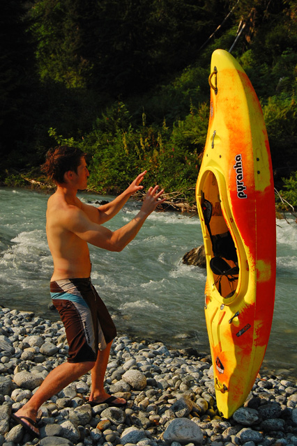
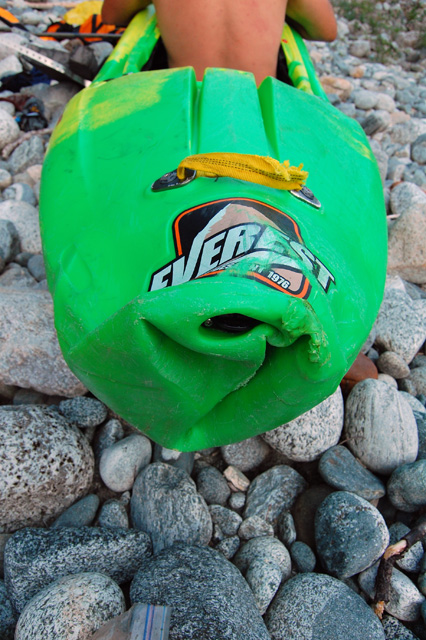
The biggest break of the trip came here as well - we found Corey's boat, and while it was demolished it didn't have and cracks in the hull and after he portaged it around the big stuff of the day we were able to bash, melt and weld it into shape enough for him to paddle out to the lake. All of his gear was still in the boat too. Everyone slept a little easier that night knowing we'd be able to get out without too much trouble. The third day we thought would be relatively chilled out...
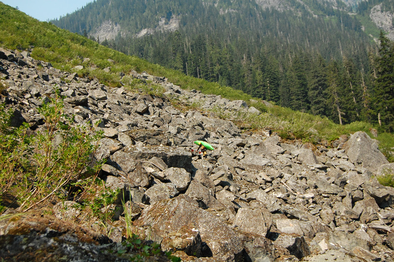
Maxi amidst the talus on the big canyon portage.
A big slide we walked around.
And the huge boulder pile right below it.
Steve ducking between some of the boulders on the second half of day two.
Matt demonstrating his knowledge of the Force.
Corey's f'd up boat.
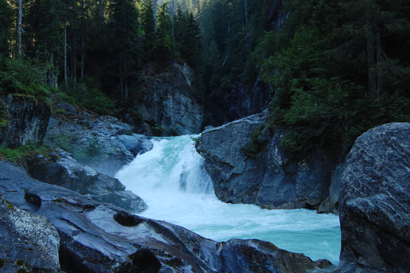
Everyone was fired up to be back on the river after a gruelling second day, and the whitewater started off great - very quickly though we came to the head of the third canyon on the Stave, which starts with a prefect 30 footer. As you can guess though, this canyon had way too much water - the falls is awesome, but right below it was an enormous river wide hole followed by more whitewater madness. The portage on the right was thick as hell but flat, and took about 1.5 hours - most of the canyon looked good (to much water though), except for one rapid in the middle - if you come to the Stave be sure to scout the whole thing first as the walls come straight out of the water and getting out would be hard, if not impossible.
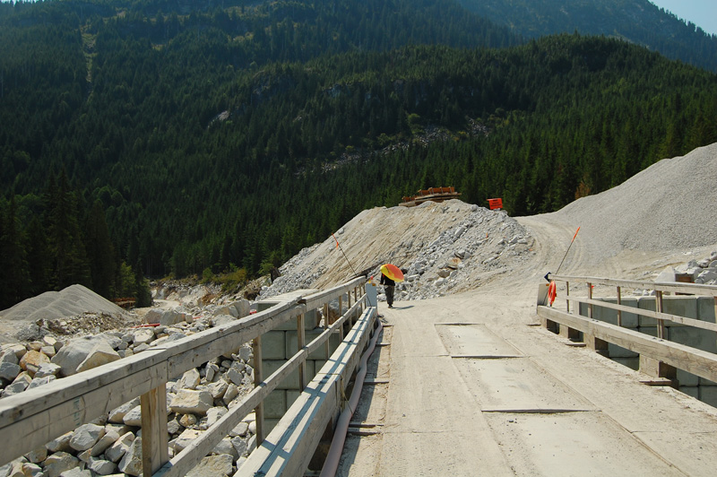
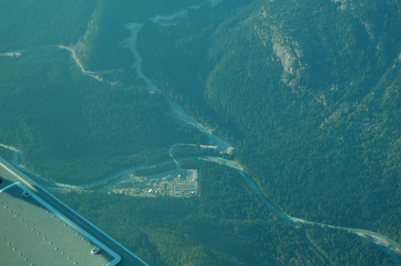
The rest of the Stave is best described as IV-IV+ with a few big ledges and waterfalls mixed in. It's all good, but some of the falls had too much water (which by this point wasn't a suprise). There is a road along the river, and the valley has been heavily logged. All in all really great whitewater, but very unexpectedly and not at all welcome was the discovery of a hydroelectric project that is nearing completion. It's going to dewater the best stretch of the river below the third canyon, and the destruction here is complete - a section of river at the intake is diverted and the original riverbed is gone. Soon, when the dam is done, about 3 km of river will forever be lost - certainly when the upper river is/might be prime this section will be all but dry. The Stave isn't the only victim here - concurrently, a side creek is also being divereted in this area, and the second power house is on the opposite side of the river from that of the Stave diversion.
This BC forest at the end of the third canyon portage.
Taking a look at something on the lower river above the dam.
A fun boof.
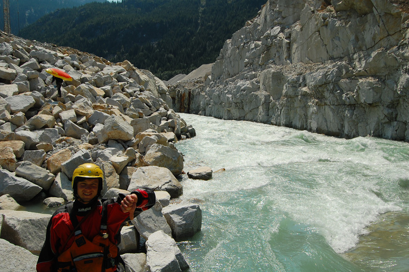
An unfortunate discovery - a diversion channel around the construction site.
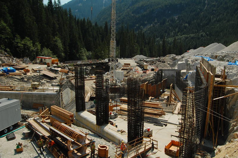
The industrial complex of the Upper Stave Hydroelectric Project.
The first half of a double waterfall, too high as well - the second uniform ledge (out of the photo) had an enormous hole at the bottom.
Sweet class IV below the falls (as seen from a road scout), soon to be dewatered.
The whitewater is over after the powerhouses and it's a long cruise out to the lake with some great scenery - it reminded me of the scene at Fantasy Falls in Cali on the way out. As we got close to the lake we called in the plane from Whistler to pick us up, and after paddling out on the lake to get clear of the dead trees near the river we were shortly in the air, enjoying the flight back up the valley towards home, and a big feed at Splitz.
And that's the story of the Stave River. Things started out strong with a fantastic first day on the river. We worked out the shit that went down late on day 1, and figured out the portage on the morning of day 2 with no rope work, just hard work. Most of the stuff we ended up walking on the rest of days 2 and 3 (and the canyon Corey swam) are probably runnable at lower flows. If they are good to go, the Stave has the potential to become one of the best class V multi day trips in southern BC, adding to an already impressive list of great rivers. The dam will from now on always be a problem though - have fun sorting this out, and be ready for a hard but rewarding trip. If you'd like some detailed logistical notes, click this link to check out the beta page.
Calling in the plane.
All smiles while loading up on the lake.
The dam site - you can pick out both powerhouses if you look closely at this photo.
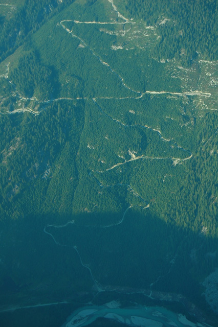
Logging in the Stave valley.
Some more cool ice on the flight home.
The summer of '09 was a bad one for fires in BC - here's a big one in the Lillooet River valley.


3 comments:
Great trip report. Amazing story about your buddy Cory...glad he made it out of that swim. Too bad about the dam. I'm glad you guys were able to experience this amazing place, and thanks for sharing it with the rest of us!
Amazing shots and scenery, really love this area. Yes it is unfortanate the the hydroelectric projects will have an effect on the water coarse, but not to the extent as mentioned. The most noticable part would be arriving at the Intake structure (the dam) from up stream where part of the water is channeled into the pipe, but this is only a portion of the water, roughly only 10% which will only be missing for 1800 metres of the run, once it passes through the powerhouse it is dumped back into the river, all of it. If you were to stand downstream of the powerhouse you would have no idea that water was used to produce power. The same is for the secondary creek feeding into Stave River, the Lamont Creek uses 10% of the water to produce power which is returned to the stream before it enters the Stave, this will have zero effect on the river down stream of these power houses. As mentioned above only 10% of the streams are used and only after a minimum flow is achived, during the hot dry season the Lamont Creek cannot support power requirement and zero water is used, it is at 100% flow. On Stave River the Intake structure is located a few metres before the falls the would require a detour anyways.
From the standpoint of a river user, these river stretches will never again be the same. 10 % of the flow must mean 10 % of the annual discharge - following the pattern of other run-of-the-river projects, this means at times of low flow needed to run the river, almost all of the stream will be diverted in to the pipe. Take for example Rutherford Creek - this stream only has enough water to be paddled at times of peak snowmelt - only when the pipe can't accomidate the whole volume of the river and it spills over the dam. I don't see why the Stave will be any different.
Saying a rapid is not nagivable (...require a detour anyways) is not a reason to say dam building is ok, and while it's great there will be water below the powerhouse this is little consolation for whitewater boating because, well, there are no rapids between the powerhouse and the lake. In my understanding, a second permit has been granted upstream of the current project - this will further take away from the rivers' recreational value.
While the development of green energy is an important pursuit, is it necessary to dam every river in southwest BC? Taking a look at the number of IPP applications for the region this is a definite possibilty. There must be balance here - unchecked hydro developement is unacceptable.
Anyhow, thanks for the comment - how did you come across this site? We spoke with a number of the guys working at the site this summer - they were quite fired up to see us coming through.
Post a Comment